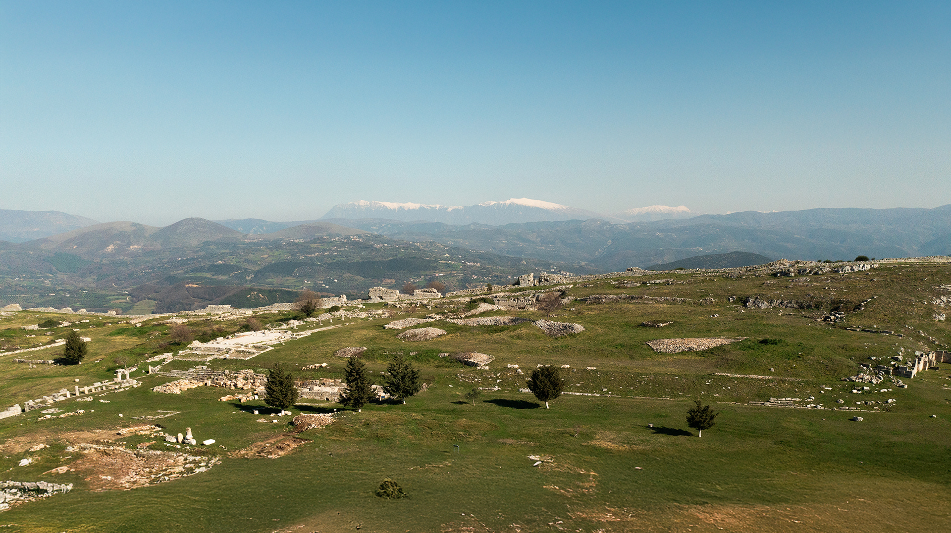
Bylis
The Heart of Ancient Illyria

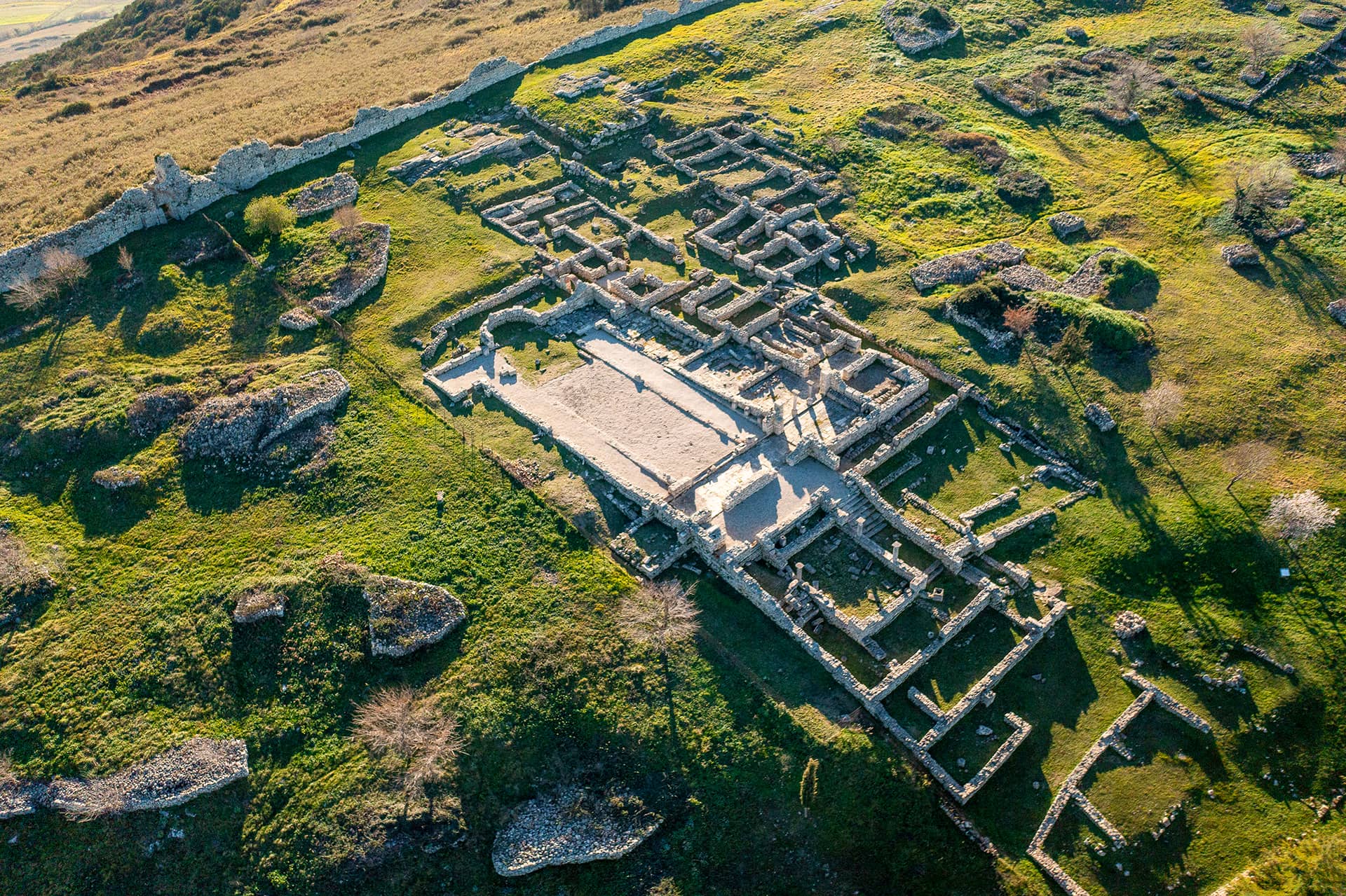
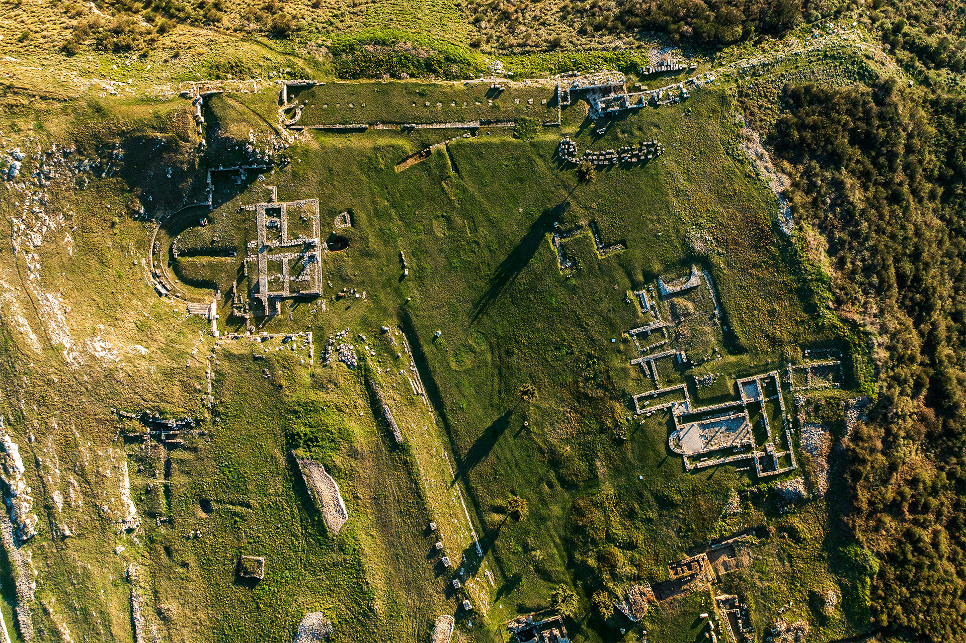
Urban planning
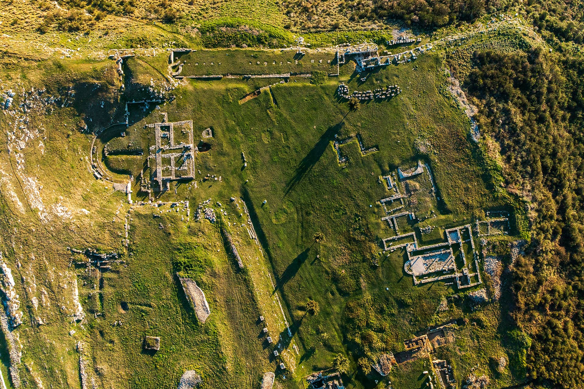
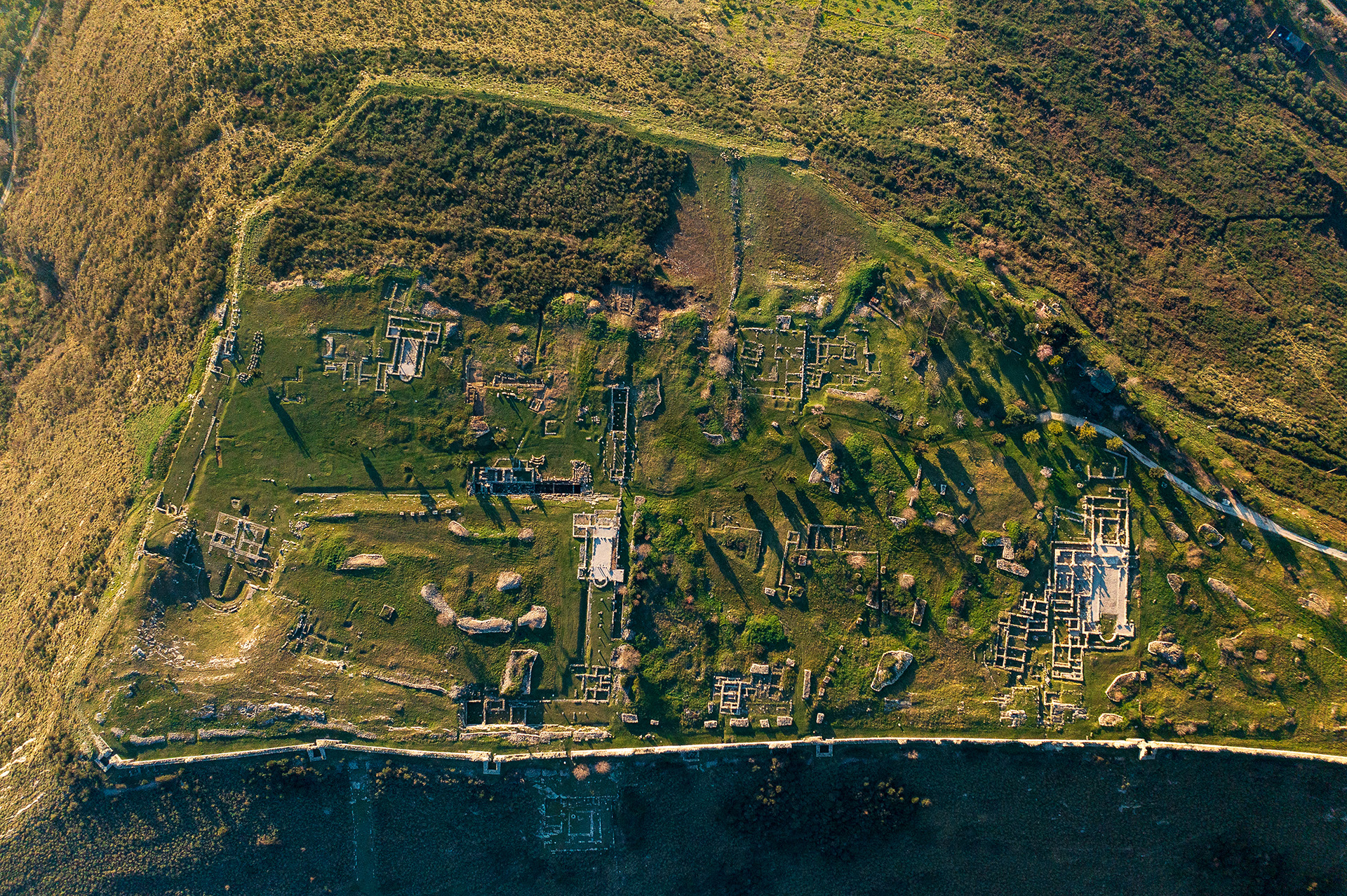
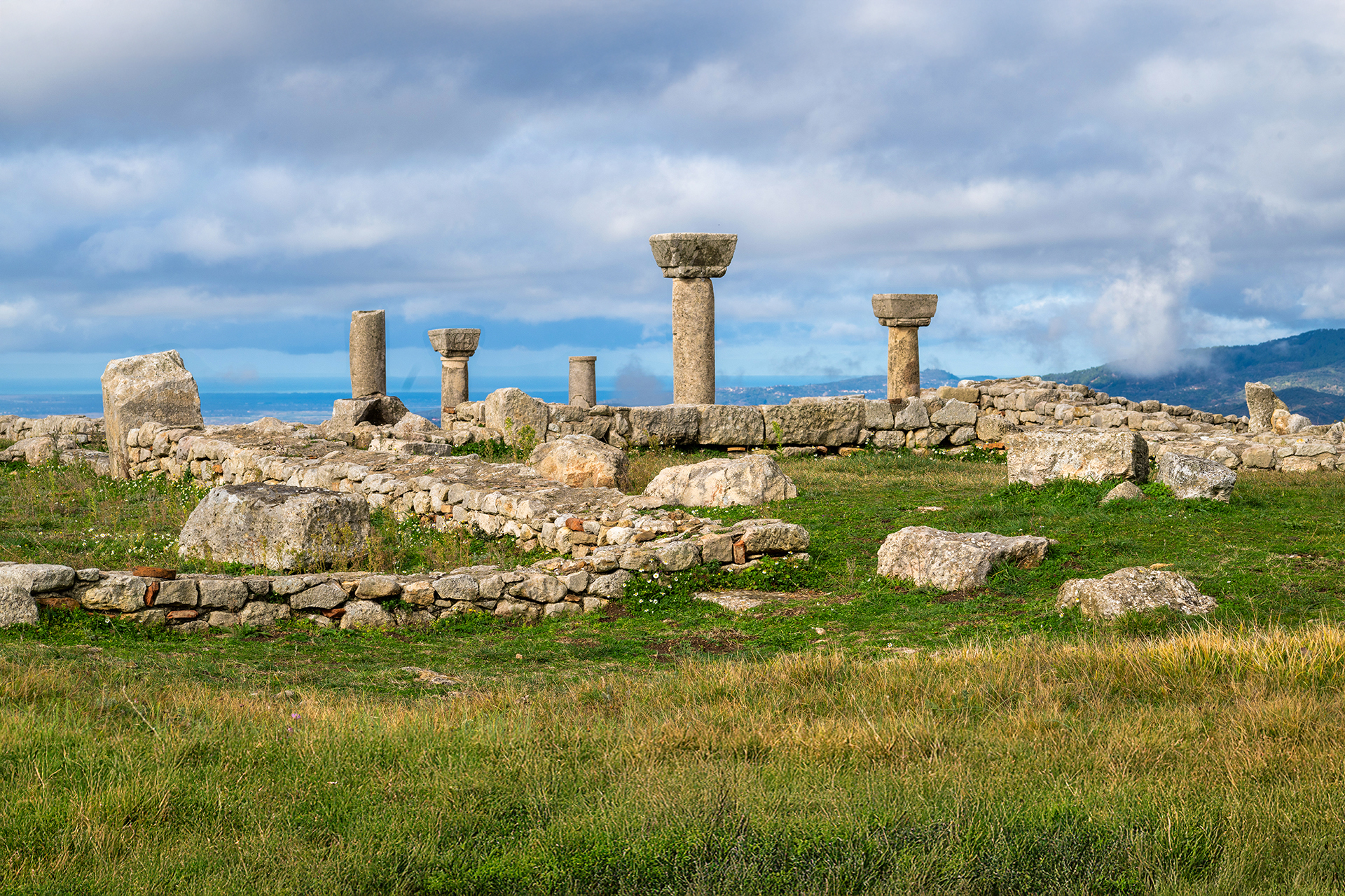
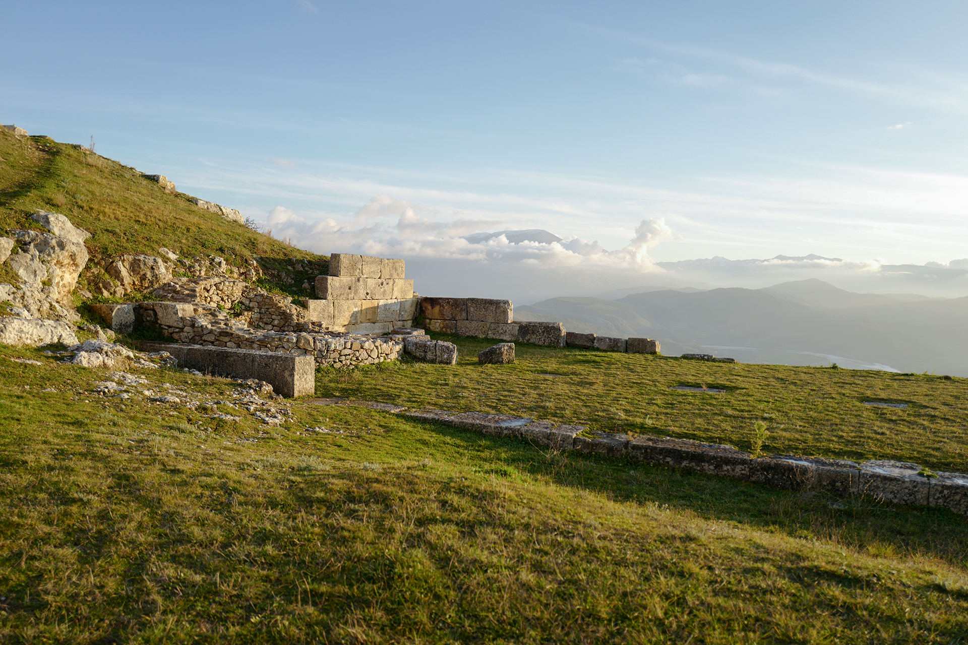
Byllis was the largest and most organized city in Southern Illyria. Unlike most ancient cities, its urban plan did not include a separate acropolis, but rather featured a clear division into three main zones: the agora (public square), the residential area, and the free space.
The formation of the agora, with all its grand monuments – such as the theater, stoas (porticoes), gymnasium, and other public buildings – took more than a century after the city’s foundation. The urban layout was also consolidated in the mid-3rd century BCE with the implementation of the typical Hippodamian plan: streets intersecting at right angles and dividing the city into evenly sized residential blocks (insulae).
During the Roman period, the city’s urban plan remained largely unchanged, except for the reconstruction of some major monuments. In Late Antiquity, this classical structure was replaced by a new urban model: homes began to cluster into neighborhoods around the newly built churches in the city.
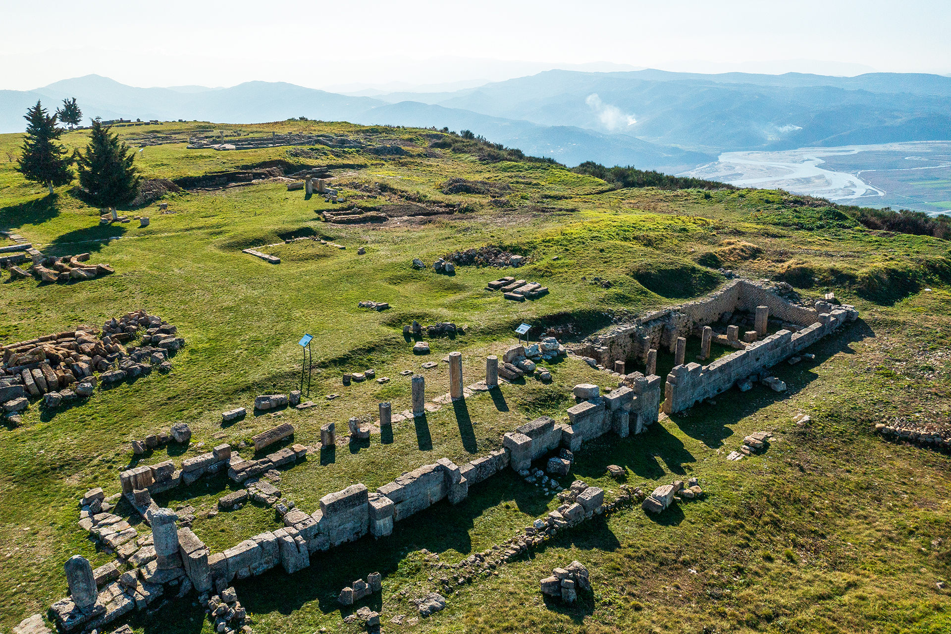
Byllis in Late Antiquity
At the end of the 4th century CE, Byllis likely suffered significant destruction and burning during the Visigothic incursions, much like many cities along both sides of the Adriatic coast. Despite this setback, the city was rapidly rebuilt under the reign of Emperor Theodosius II in the first half of the 5th century. During this time, several churches were constructed, and the urban layout was reorganized into residential neighborhoods clustered around these new Christian centers.
By the mid-5th century, Byllis had become an important episcopal seat within the province of Epirus Nova, alongside other major cities such as Dyrrachium (modern Durrës), Apollonia, Aulon (Vlorë), and Scampin (Elbasan). Another wave of barbarian invasions struck the city in the mid-6th century, but once again, Byllis was fortified—this time under the oversight of the official Victorinus. A new defensive wall was erected on the eastern side of the city, although it enclosed a smaller area, excluding nearly one-third of its original expanse. Unfortunately, this resilience was short-lived. In 586 CE, following a second devastating attack by Slavic tribes, Byllis was permanently abandoned
Location Map of Revelant Monuments
-
Basilica D
-
Gate nr.6
-
Fortification walls
-
The Cathedral (Basilica B)
-
House B
-
House A
-
Gate nr.4
-
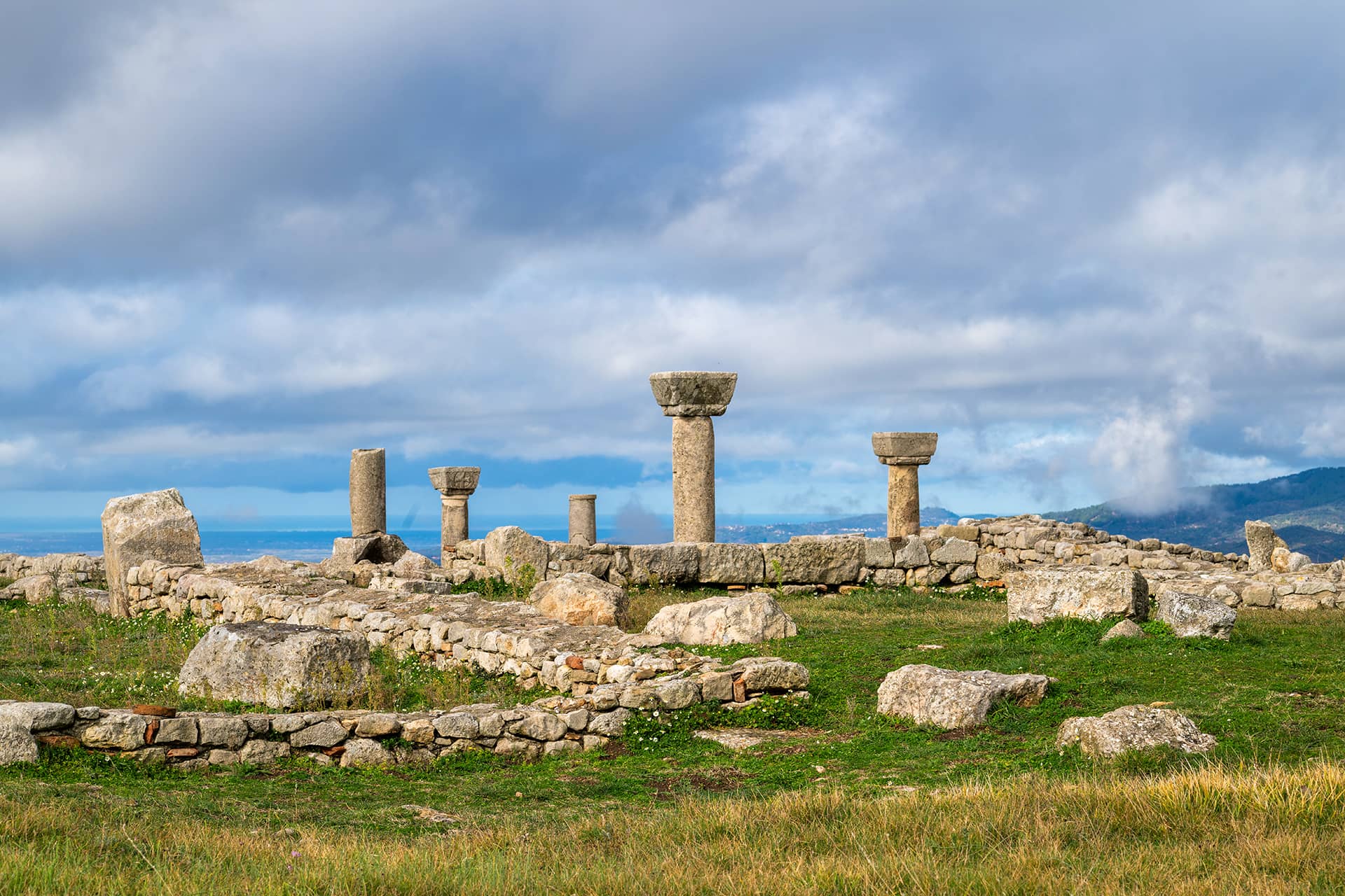
Agora and the Prytaneion
-
Large (Northern) Stoa
-
The Baths of Justinian
-
Basilica C
-
Stadium and the Cistern
-
Gymnasium
-
Gate nr. 5
-
Southern Stoa (Theatre Stoa)
-
The theatre
-
Basilica E
-
The Inscription of Mark Lolianus
-
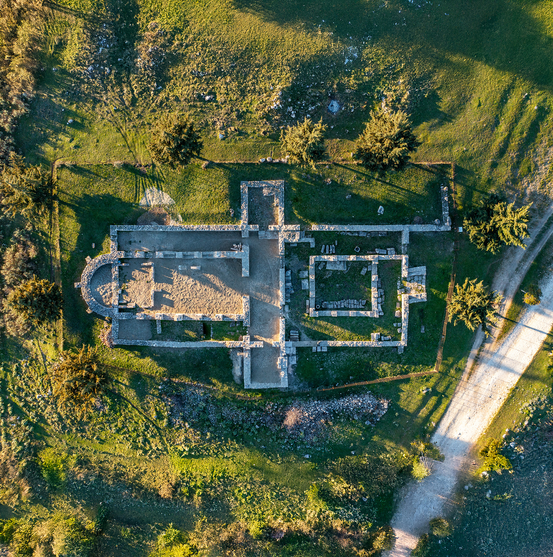
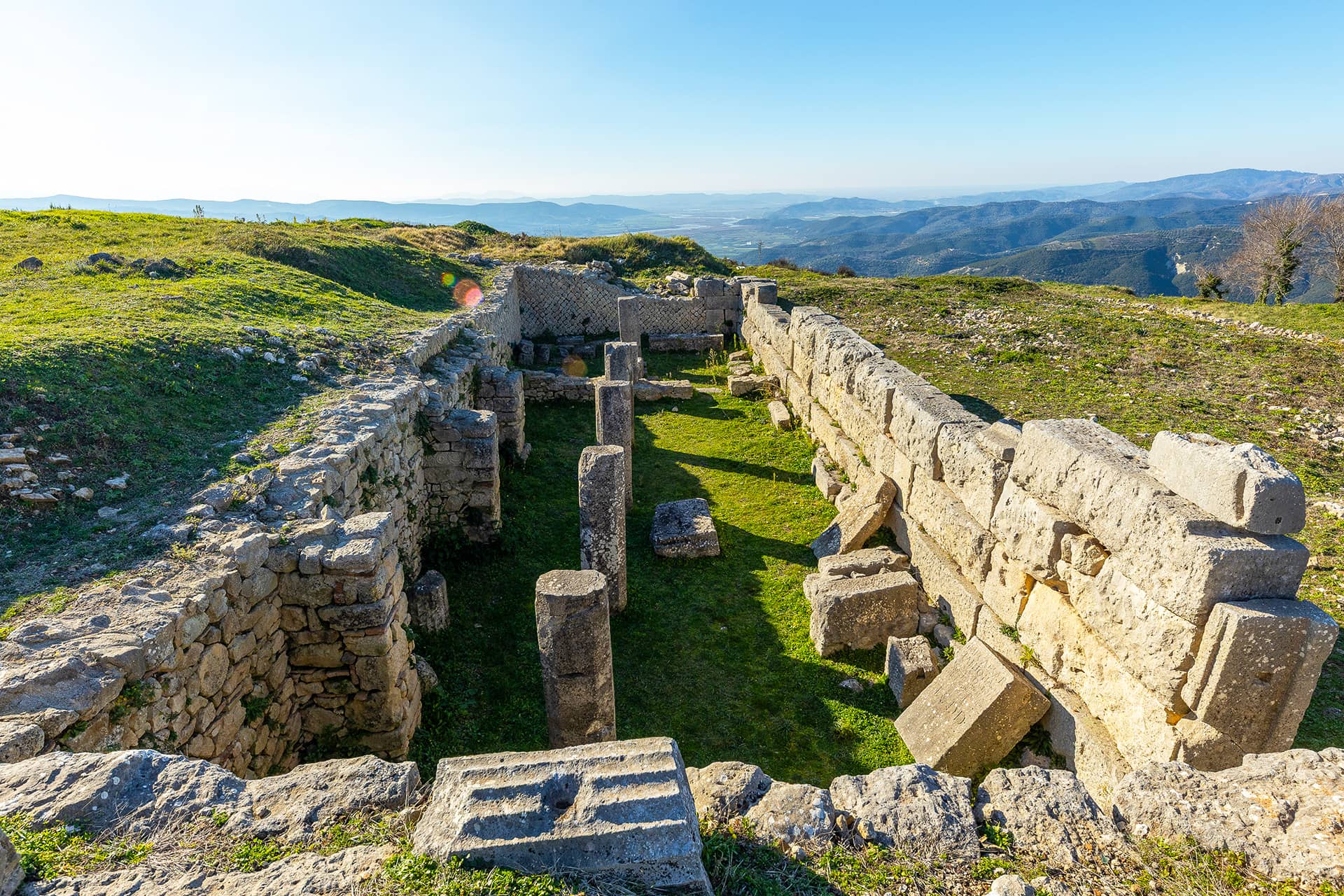
Basilica D
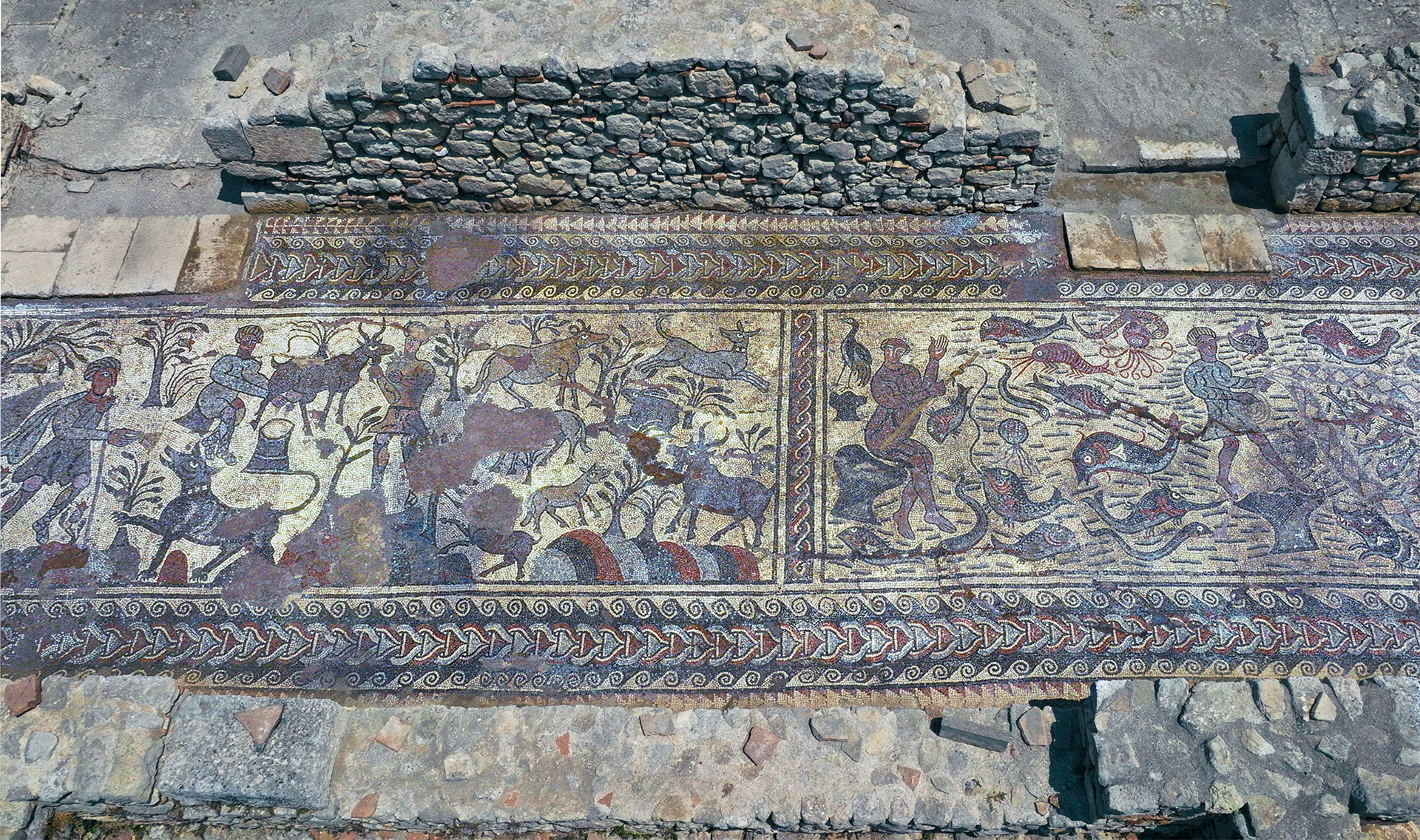
Basilica D stands just outside the Victorinus wall, in the northern part of the city. The basilica features a three-aisled plan with a semicircular apse supported externally by three counterforts. A western narthex, flanked by two annexes, leads into the church, and a large atrium with four porticoes, added in a later phase, extends westward, forming a formal entry space.
Floor decoration throughout the basilica is rich and varied. The central nave and proston feature elaborate mosaic panels with animals, birds, rivers of paradise (with inscriptions), and floral and geometric designs. Inscriptions within the mosaic name Bishop Praisios. The narthex mosaic is especially well-preserved, with bird medallions and carpet-like compositions, while the annexes display unified geometric patterns and figural panels, including deer. Marble, ceramic tiles, and stone slabs complete the flooring in other areas..
Dating from the early 5th century AC, Basilica D is a prime example of early Christian architecture in Bylis, distinguished by its structured ornamentation, complex building phases, and vibrant mosaic art that reflects both theological and artistic aspirations of the time.
-

Gate nr.6
Gate No. 6 of the ancient city wall served as the main entrance throughout the entire existence of the city. This gate is often called the “Gate of Apollonia” because it marked the beginning of the road leading from Byllis to Apollonia, passing over the ridges of the hills and the ancient settlement of Gurzeza.
Access to the gate was strategically controlled by a bend in the wall and Tower F. The entrance corridor, measuring 7.60 meters by 2.40 meters, was formed between two parallel arms of the city’s surrounding wall. The gate featured two portals: one at the very start of the corridor and a second located 4.20 meters further inside. The entrance was covered by a tower measuring 9 by 7.60 meters, built on arches over the corridor.
At the threshold of the gate, there are two grooves carved for the passage of carts and water. During a later construction phase in the 3rd to 2nd centuries BCE, this tower was demolished and replaced on the right side of the entrance by a rectangular tower measuring 6.10 by 4 meters.
The gate underwent repairs during the Byzantine period in the 5th century, reusing blocks from the older Illyrian walls, as well as a Latin inscription on the left side of the entrance. Partial restoration of the upper sections was done by the scholar Victorini. Another repair phase, involving reused blocks bonded with clay, likely dates to the 13th or 14th centuries CE, when the ruins of Byllis were used as a military camp.
Before the gate, on both sides of the road, part of the city’s necropolis was developed, with several burial stelae dating back to the 3rd century BCE.
-
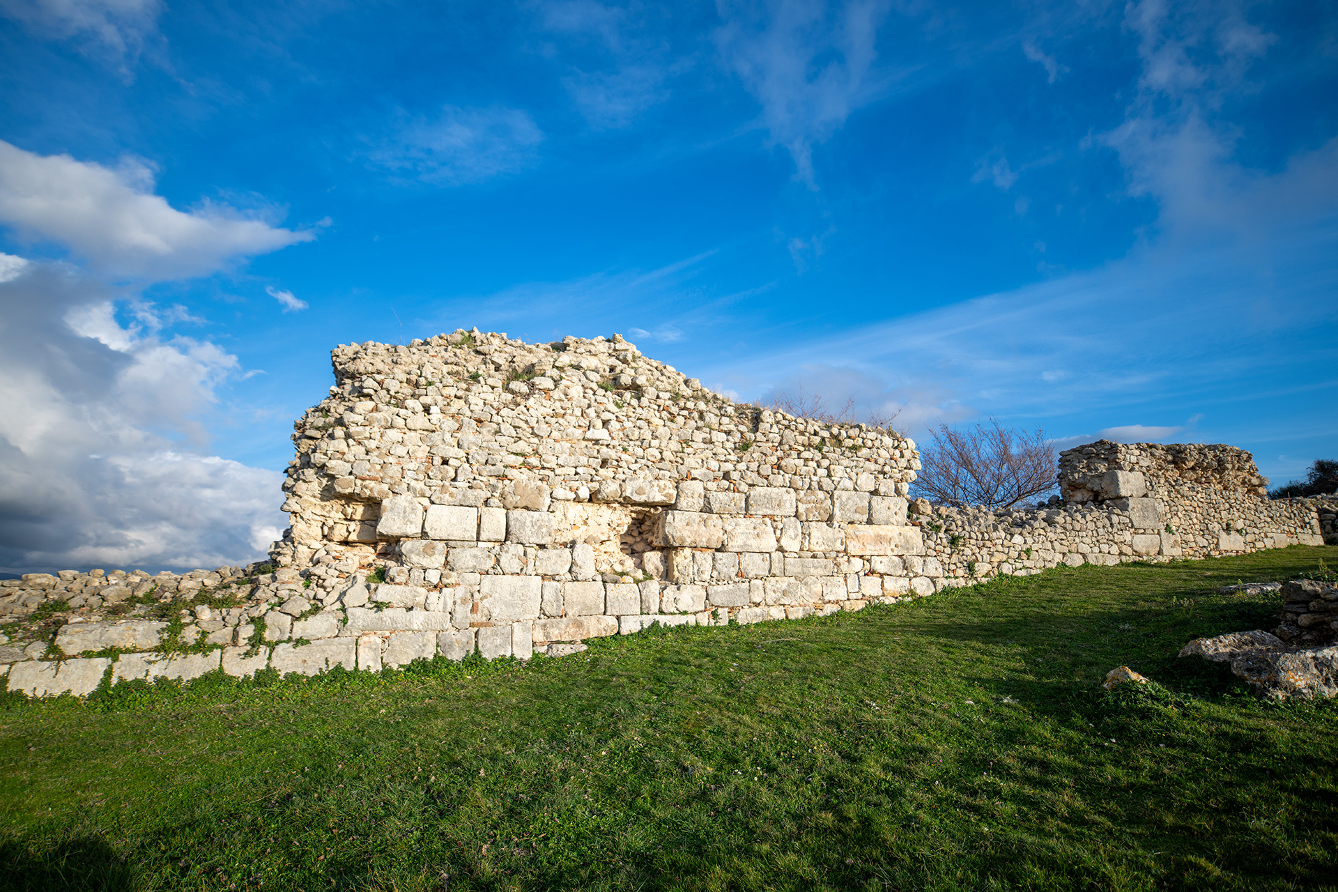
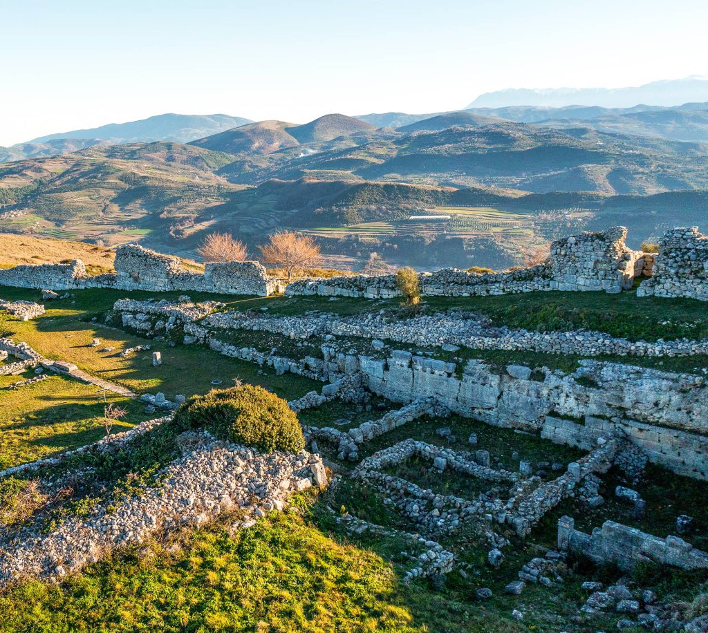
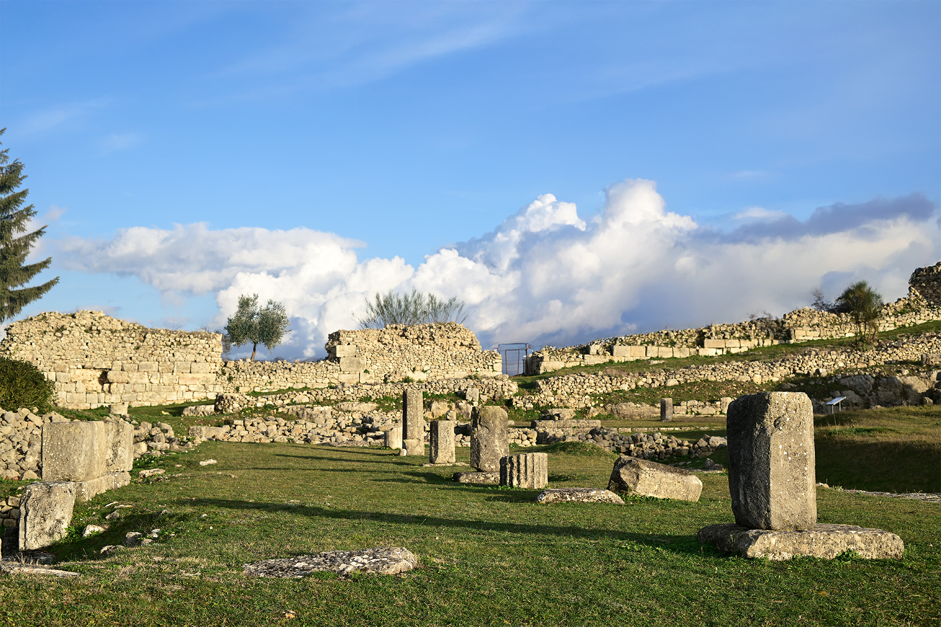
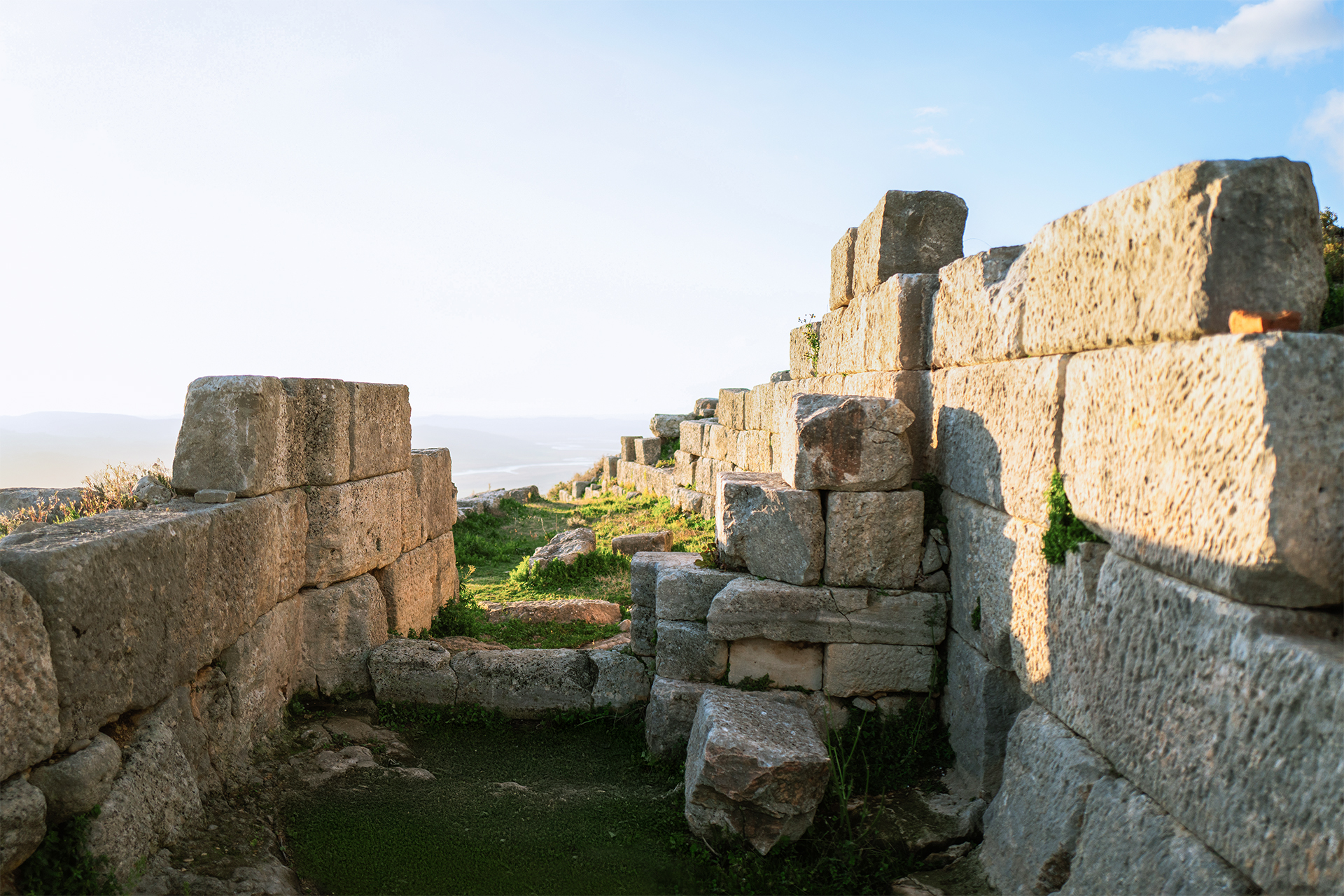
Fortification walls
The fortification walls of Bylis are among the most impressive elements of the ancient city, well-preserved and a clear testament to its organization and development. With a length of 2,250 meters and enclosing an area of 30 hectares, they make Bylis one of the largest centers of Illyrian civilization.
The plan of the walls, which is nearly triangular, follows the topography of the hill on which the city was built, naturally benefiting from the protection offered by the terrain. Within the walls, at least six city gates and seven defensive towers have been identified, placed strategically where the terrain is most exposed to outside attacks. This reflects careful planning and a high level of mobility already present in antiquity.
The walls were constructed with large limestone blocks, using refined techniques and demonstrating impressive durability. Their width reaches up to 3.5 meters. Archaeological evidence points to three construction phases, beginning in the 4th century BCE and continuing into the 6th century CE, with significant interventions by Emperor Victorinus. This later phase also marks a reduction in the enclosed area, showing the city’s adaptation to changing circumstances. The structure and evolution of these walls are a powerful testimony to the political, economic, and military development of Bylis, an aspect best experienced in person on site. -
The Cathedral (Basilica B)
Built at the end of the 4th or beginning of the 5th century, Basilica B is one of the most complex early Christian monuments in Bylis. Located within the Victorinus enclosure, it formed part of a larger episcopal ensemble that included a baptistery, an episcopal palace, and surrounding quarters. The basilica was constructed over earlier Hellenistic and Roman structures, and underwent at least three major phases of reconstruction.
The basilica’s layout is distinguished by its intricate plan: a three-aisled nave, a semicircular apse, a prominent transept, a narthex, and an exonarthex leading into an atrium with porticoes. The baptistery, located south of the narthex, originally featured a rectangular hall with a central font supported by columns and later transformed into a cruciform plan with mosaic flooring.
The interior once displayed richly decorated mosaics, notably in the exonarthex where scenes of shepherds and fishermen were rendered with remarkable vitality. These mosaics, crafted in two distinct phases, reflect the work of the renowned Ohrid workshop and demonstrate the artistic and spiritual significance of the site.
Basilica B is a key testament to the religious and cultural prosperity of Bylis in Late Antiquity.
-
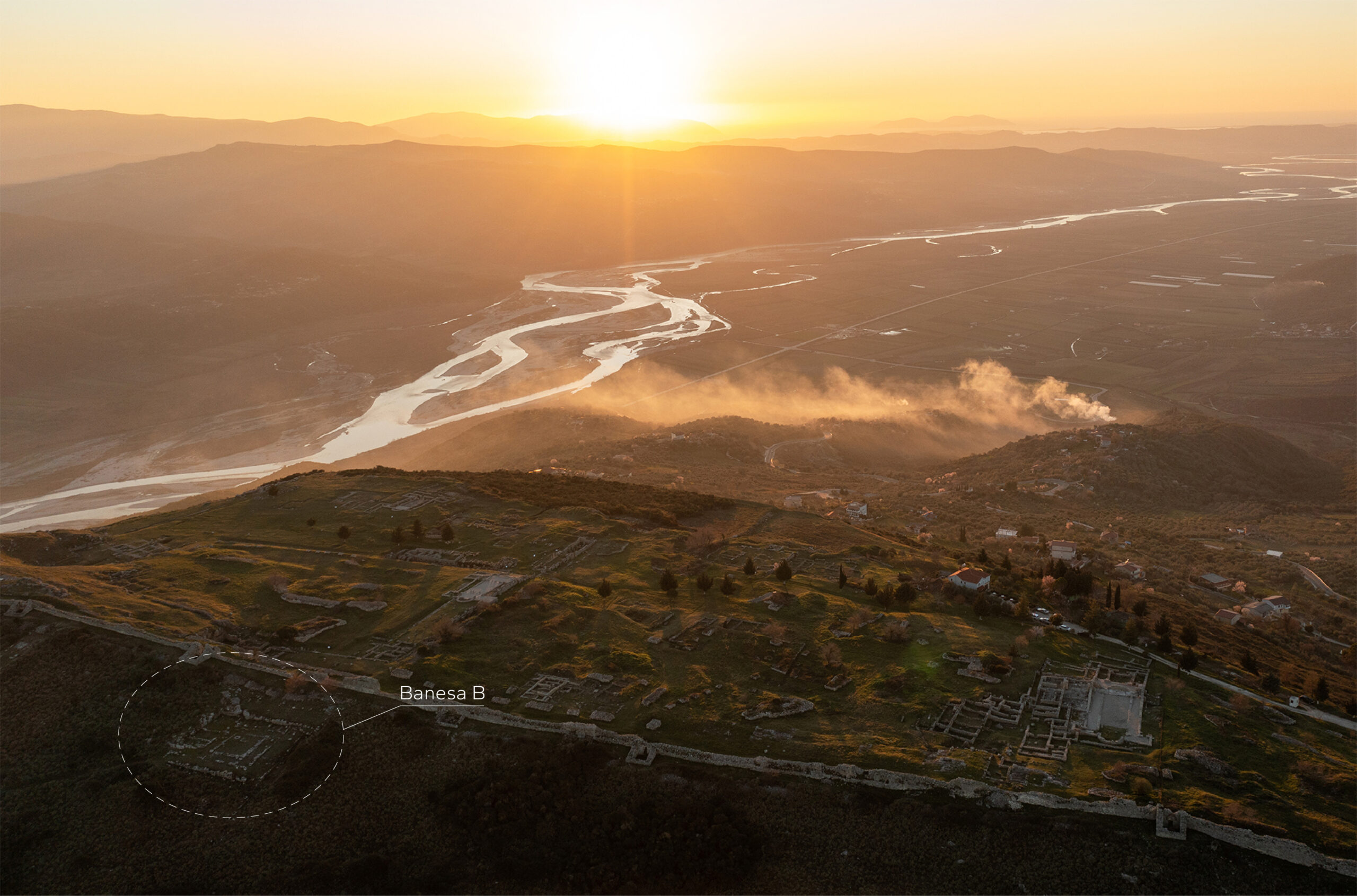
House B
House B was constructed in the 3rd century BCE by a wealthy family and remained in continuous use until the 4th century CE.
Originally designed in the peristyle style, the house features a distinctive layout that combines the classical peristyle with the traditional hajat (open porch). At the center of the composition lies a courtyard surrounded by a Doric colonnade, which provided access to rooms on the eastern and northern wings. The southern and western sides were arranged as hajate, likely serving economic or domestic functions.
The main room, known as the andron, is located on the eastern side and retained its ceremonial or residential role throughout successive reconstructions. In the 3rd century CE, its walls were plastered and painted, marking a phase of decorative renewal.
By the 5th century CE, archaeological evidence indicates that two smaller, two-room dwellings had been constructed atop its ruins. In the 6th century CE, the site was transformed into a burial ground, possibly to accommodate newly arrived populations. -
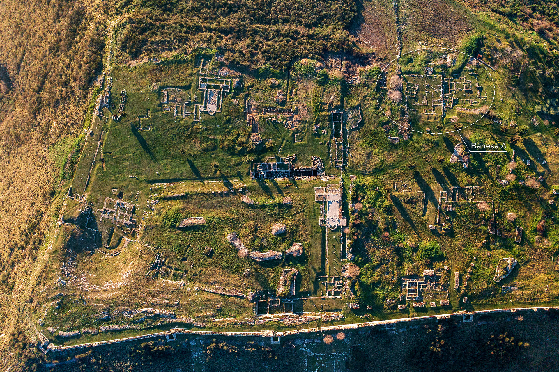
House A
House A was constructed in the 2nd century BCE and stands out as one of the largest and most monumental private residences in ancient Byllis. Likely belonging to a member of the local elite or civic magistracy, the house remained in use—with several phases of renovation and adaptation—until at least the 4th century CE.
The house was designed in the peristyle style, organized around a central courtyard framed by a colonnade. This layout offered direct access to residential rooms arranged along the eastern and northern wings, while the southern and western sections likely included service or storage spaces, indicating a combined residential and economic function.
Its scale and architectural refinement, including carefully paved floors and the use of decorative plaster in certain rooms, reflect the status and wealth of its original occupants. Over time, the house underwent structural changes, especially during the Roman period, when parts of the interior were reorganized, and new functional spaces—such as baths or storage rooms—may have been added.
By the 4th century CE, the residence shows signs of decline, mirroring broader urban transformations in Late Antique Byllis. Though no longer used as a full residence, the site retained traces of secondary activities before its eventual abandonment. -
Gate nr.4
The largest and best-preserved gate in Byllis, Gate No. 4 is located midway along the eastern wall, where the fortifications begin to ascend the hillside. It once served as a key connection between the city and the nearby settlement of Klos.
The entrance corridor, 8.45 meters long and 4.20 meters wide, was protected by a massive tower measuring 10.85 by 8.45 meters. The tower stood on three arches supported by six buttresses arranged along both sides of the corridor.
The gate remained in use into the 5th and 6th centuries CE, although it was narrowed during this period.
-
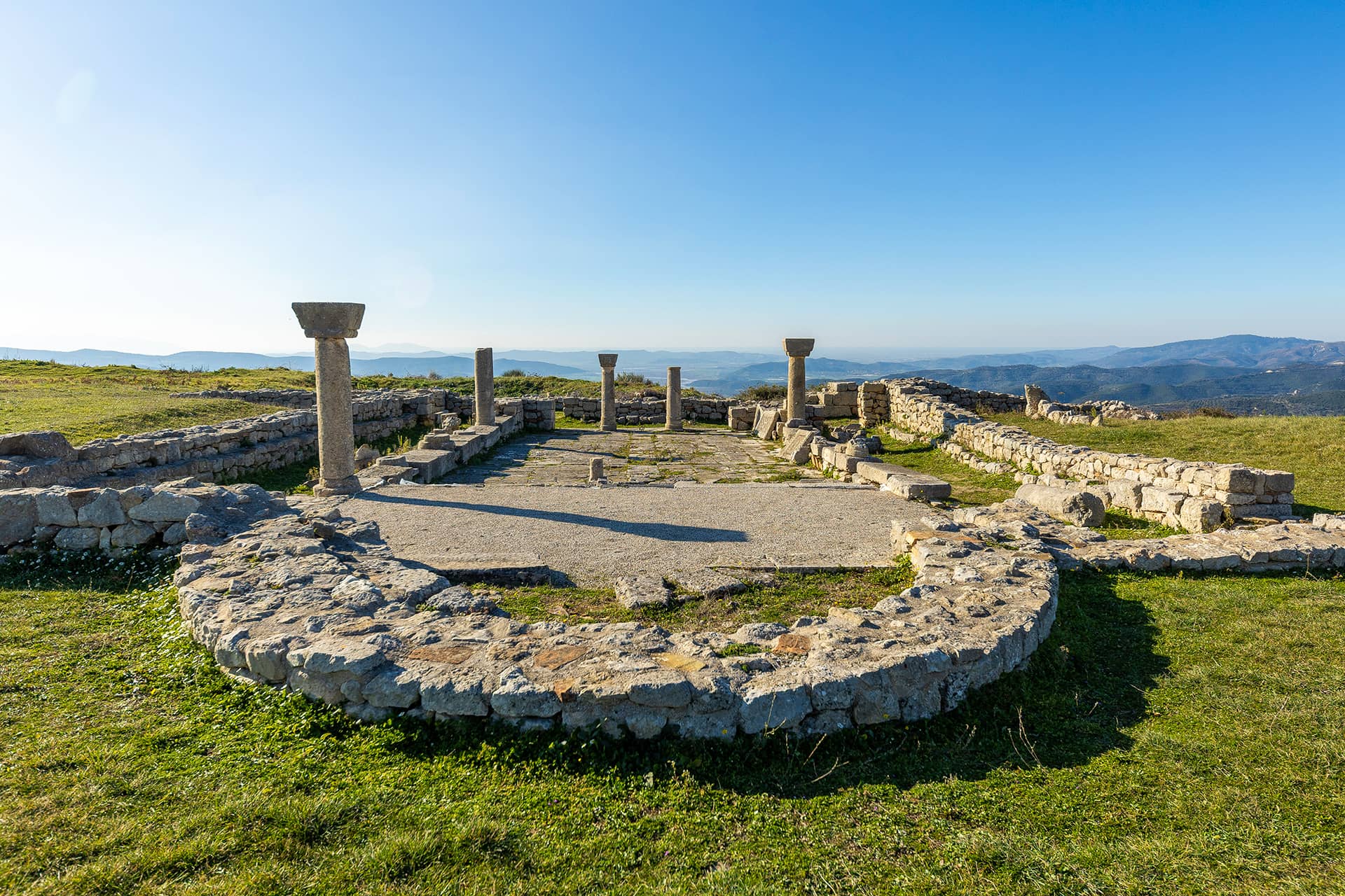
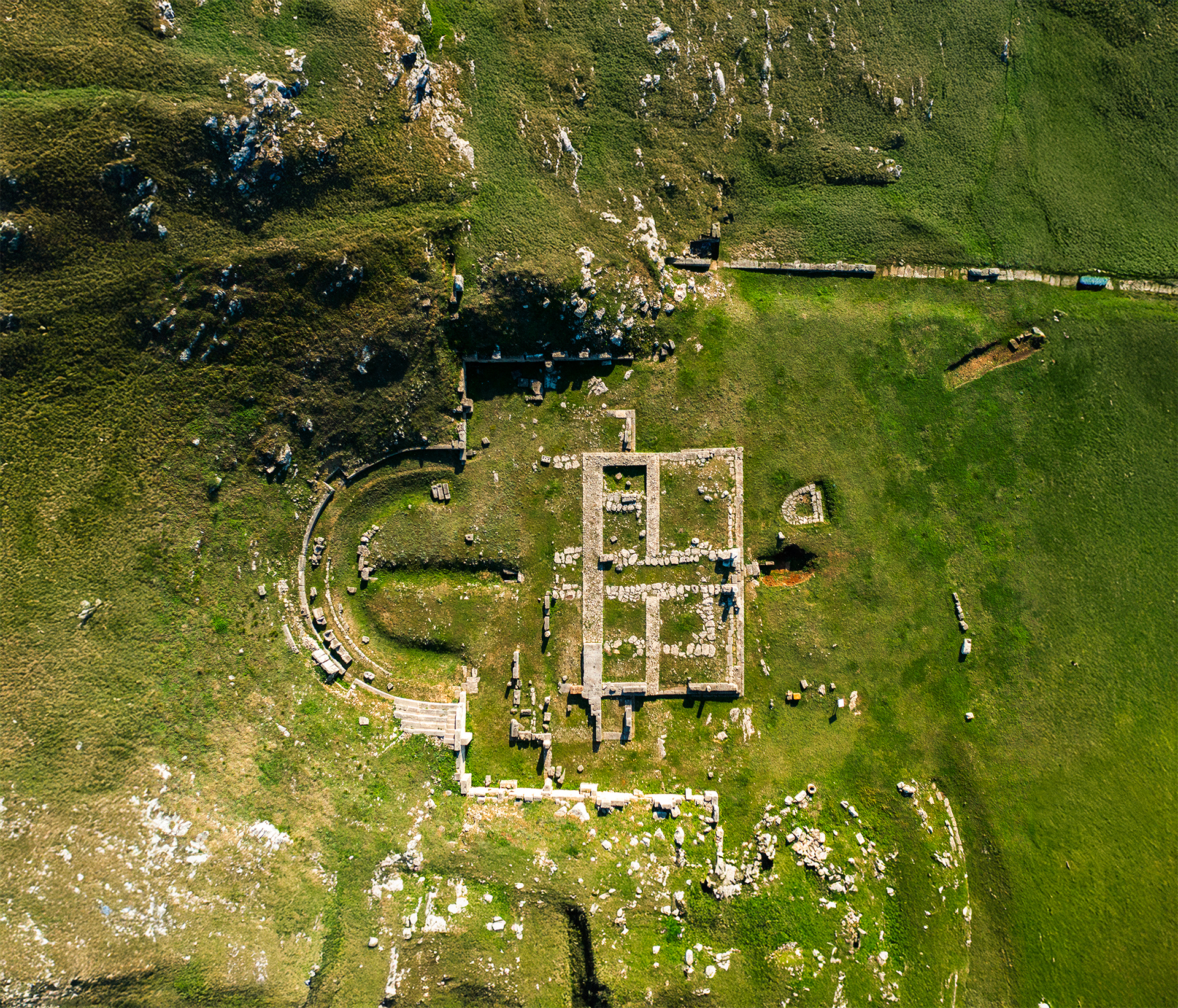
Agora and the Prytaneion
In the heart of the Agora of the ancient city of Byllis lie the ruins of the Prytaneion, the seat of the magistrates and the highest official of the koinon. This building, constructed in the mid-3rd century BCE, consisted of two rooms and a wooden colonnaded porch (hajati) that separated them. The structure is believed to have had a ceremonial function as well, since near one of the rooms a channel was discovered, which may have been used for washing foods intended for ritual meals.
During the Roman phase, in the 1st century CE, the building underwent transformations. A stone basin was added, suggesting a change in function—possibly into a workshop or some economic facility.
During excavations, a Latin inscription dating from the time of Emperor Augustus was uncovered. It records the erection of a statue by decision of the council of decurions and under the care of two duumviri. Only the name of T. Petronius has been preserved, while the name of the other has been deliberately erased as an act of damnatio memoriae, a punishment for political reasons.
Near this site, another important inscription was discovered, dating to the 2nd century BCE, dedicated to the goddess Artemis. The inscription mentions the name of the prytanis Triteutas, a typical Illyrian name, providing evidence that at that time the city’s leadership was in the hands of the local Illyrian elite. -
Large (Northern) Stoa
The Large Stoa stands on the higher platform of Bylis’ agora, shaping the northern and eastern edges of this central public space. Built in the second quarter of the 3rd century BCE, it marks an important phase in the monumental development of the city. The stoa has an L-shaped layout, with the eastern wing stretching 73 by 11.4 meters and the northern wing 68 by 11.4 meters. Both wings are connected by a wide corridor that also served as an entrance to the agora. The building’s back is supported by the natural rock of the hill, integrating architecture with the landscape.
This two-story structure was designed with functionality and style in mind. The ground floor featured sturdy Doric columns, while the upper floor was adorned with more decorative Corinthian columns. Each floor had two passageways, and staircases at the ends allowed movement between levels. Archaeological findings reveal rich architectural details, offering insight into the advanced construction techniques of Bylis and the importance of the stoa in the city’s social and commercial life. -
The Baths of Justinian
The Roman baths discovered in the ancient city of Byllis are believed to have been built during the reign of Justinian I (527–565 CE), as confirmed by an inscription found on the city walls.
They represent a typical example of Late Antiquity architecture, incorporating all the characteristic spaces of Roman bath complexes: the apodyterium (changing room), tepidarium (warm room), caldarium (hot room), frigidarium (cold-water baths), sudatio (sweating or steam room), and praefurnium (the furnace and fire chamber).
During the archaeological excavations, several coins were found in the praefurnium, minted during the reigns of Emperor Justinian I and Baduila, king of the Ostrogoths. -
Bazilica C
Located within the Hellenistic agora of Bylis, Basilica C occupies a prominent and symbolic position in the urban landscape. Beneath its central nave lies an earlier residential domus and a cistern, suggesting a long and layered occupation of the site.
The basilica stands out for its sculptural elements and floor decoration. Locally carved parapets and capitals feature crosses, floral, and geometric motifs. Mosaics in the sanctuary and annexes depict lambs, birds, human figures, and a lion, alongside geometric designs. Flooring includes mosaics, ceramic tiles, opus sectile, and rammed earth, with stone paving in the central nave.The archaeological discoveries support the dating of the construction of Basilica C to the second quarter of the 6th century.
-
Stadium and the Cistern
The stadium of the ancient city of Byllis, built around the mid-3rd century BCE, presents a unique architectural solution: only one of its sides is supported by the natural slope of the terrain. Measuring approximately 190 meters in length, the stadium extended along the track in front of the theatre and was designed for athletic competitions, which the audience watched while standing.
An inscription preserved on one of the steps commemorates the manumission of a slave a direct testimony to the social and legal life of the city.
The most distinctive feature of this stadium is the construction of a monumental water cistern, dating to the same period as the stadium itself. This cistern collected rainwater that ran off the stadium steps and the roof of the Great Stoa. Covered with arches made of limestone blocks, it stands as an excellent example of urban water management in antiquity.
During the Late Antique period, parts of the stadium steps were reused as an entrance to Basilica A, thus linking two different eras in the history of the city. -
Gymnasium
South of Basilica C, archaeologists have uncovered the remains of a public building, identified as the city’s gymnasium based on its rectangular plan and the sequence of rooms arranged around a central courtyard. The structure was part of the Agora complex, aligned with the city’s urban layout, and was constructed in the second half of the 3rd century BCE using large rectangular stone blocks. Only the foundation level is preserved.
The building was destroyed during the establishment of the Roman colony, and over its ruins, a complex of public baths (thermae) was constructed. The excavated western part includes the tepidarium, caldarium, frigidarium, and four additional rooms, all built using the opus incertum technique and oriented according to the city’s grid.
An inscription from the nearby city of Klos confirms the construction of a gymnasium in Bylis during the time of Prytanis Aspimas Praugu and Gymnasiarch Kratillas Mahatas. Another Latin inscription from the 1st century CE refers to a Sallenus family member, a patron of the Roman colony, who financed the construction of a public bath.
These findings illustrate the transformation of the area over time, from an organized civic space to a Roman-era public facility, reflecting the urban and social development of Bylis.. -
Gate nr. 5
Located near the ancient theater, this gate functioned as the entrance to the city’s agora for residents of the surrounding areas.
The entrance was protected by a transverse corridor typical of early Byllis architecture. This corridor, about 7 meters long and 3 meters wide, was formed between two parallel arms of the city wall. Such a design hid the gate from direct frontal attacks and forced attackers to move along the wall’s edge, where they were vulnerable to strikes from above.
A large tower measuring 9.88 by 8.7 meters stood above the corridor on arches 8.8 meters high, controlling access.
The gate itself was set 3.6 meters back inside the corridor to avoid damage or fire during assaults. It was rebuilt during the Roman colonial period. A Latin inscription carved on a block at the right side of the entrance reads:
“Augustus, son of the emperor, the divine Caesar, allowed (the rebuilding of the walls).”
Another inscription fragment on a nearby block likely reads: “Colonia Iulia Augusta.”During the early 5th century CE, when the city walls were reconstructed, the gate remained in use but was narrowed. Later, in repairs by Victorinus, the gate was sealed.
Close to the gate lies part of the early necropolis of Byllis, containing large arched tombs constructed from finely cut stone slabs, some of which were reused in the latter half of the 6th century CE.
-
Southern Stoa (Theatre Stoa)
The South Stoa, also known as The Theatre Stoa, is located in the southern part of the ancient city, near the fortification wall and adjacent to the theatre. In antiquity, theatrical performances lasted several days, from morning until evening. Spectators therefore needed a place to rest, eat, or take shelter in case of rain. In addition to the theatre’s own portico, a separate stoa was built alongside it to serve this purpose.
This two-storey stoa measured approximately 60 meters in length and 11.4 meters in width. The lower floor featured Doric columns, while the upper floor was adorned with Ionic columns, reflecting the harmonious architectural style of the period. Each level contained two broad passageways that opened toward the agora square, offering space for gatherings and social interaction.
Due to its proximity to the theatre, the stoa played an important role in the city’s public and cultural life. It served as a place where spectators could meet, prepare before performances, or linger afterward, underlining its function as both a practical and symbolic space for community life.
Today, only parts of the foundation and the eastern wall, once directly connected to the theatre, have been preserved. -
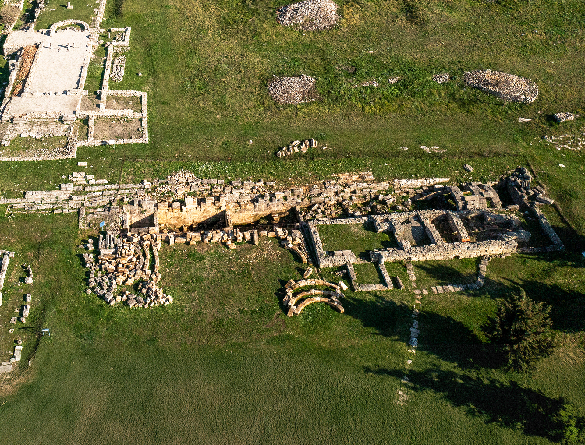
The theatre
The theatre of Bylis is the most important public monument of the agora and one of the largest structures of its kind within the territory of present-day Albania. Built in the mid-3rd century BCE, it is located in the southern part of the city, where its seating area takes advantage of the natural slope of the hill and is supported by the city’s fortification wall. Nearby are the southern stoa and Gate 5, which provided visitors from outside the city with direct access to the theatre. With a capacity of around 7,500 spectators—more than the city’s own population—it clearly served as a regional hub for the wider community of the Bylinian koinon.
The structure includes typical elements of ancient architecture: a semicircular cavea (seating area) with a diameter of 78 meters, separated from the circular orchestra by a drainage channel; the proedria, or elite front-row seats, adorned with floral motifs; and a stage building with a Corinthian façade and Doric backdrop. The analemmata—supporting walls of the seating area—and the entrance corridors (parodoi) give the theatre a monumental character. Since the theatre’s capacity greatly exceeded the city’s population, it is believed to have served the surrounding rural population as well. This makes it reasonable to assume that performances and rituals were also held in the local language, making them accessible to a broader audience. -
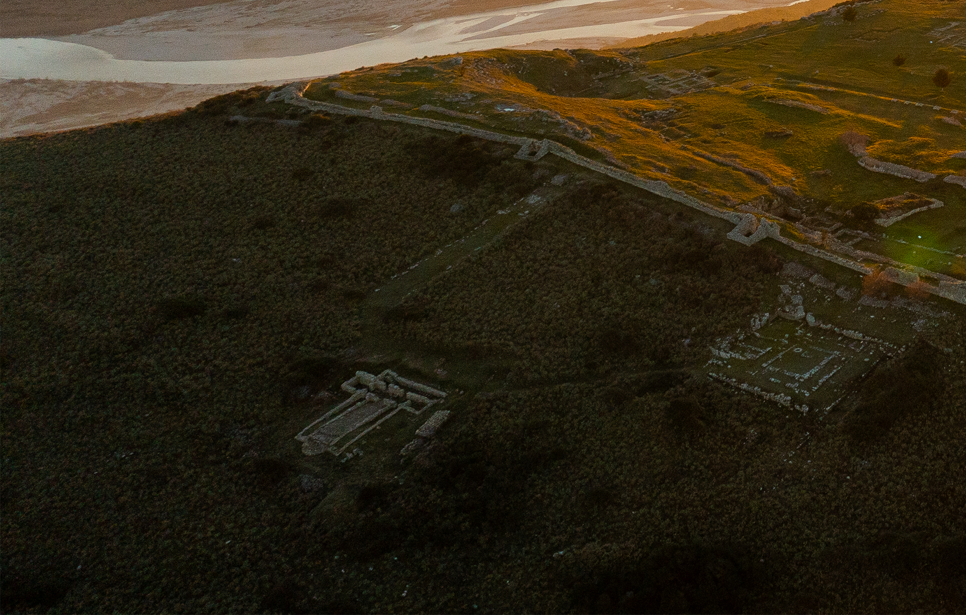
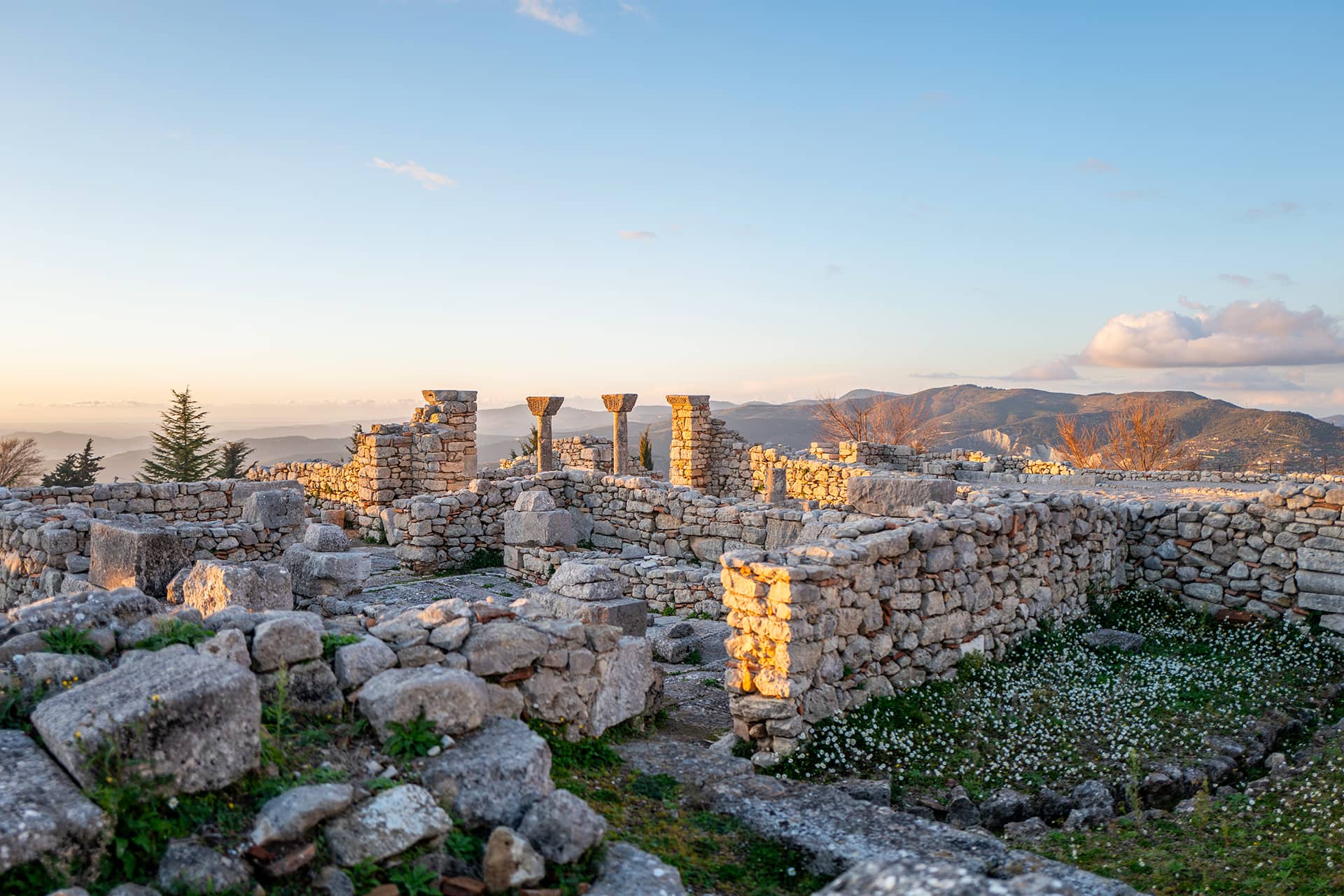
Basilica E
Basilica E stands just outside the Victorinus wall, in the northern part of the city.
The basilica follows a tripartite plan with a naos divided into three aisles by arcades supported on rectangular pilasters resting on a stylobate. The apse is semicircular, with a sanctuary and proston, while a narthex and an exonarthex complete the western section.
Mosaic flooring even though has not stood the test of time originally adorned the central nave and sanctuary. The central nave mosaic was composed of four large medallions surrounded by smaller square panels framed by a wide decorative border. The medallions displayed birds, animals, and elaborate geometric and floral motifs. The pulpit area no longer preserves its original pavement. In the sanctuary, only the western portion of the mosaic remains intact, containing a dedicatory inscription.
Basilica E, though less well preserved than some of the others at Bylis, adds valuable insight into the architectural and decorative traditions of late antique Christian architecture in the region. Its similarities to Basilica C and D suggest a continuity in liturgical layout, while its later construction phases and decorative program reflect evolving religious practices in the 5th and 6th centuries. -
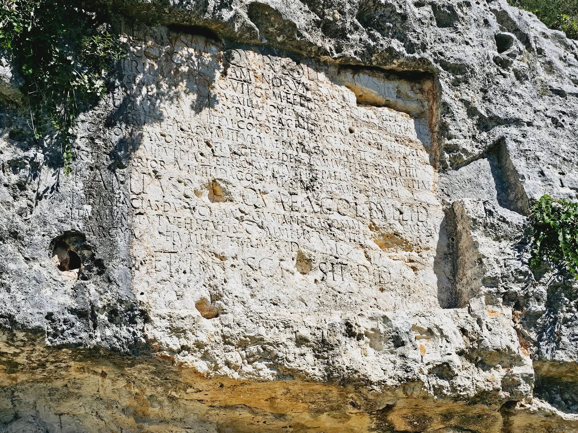
The Inscription of Mark Lolianus
The inscription of Mark Lolianus is a significant Latin epigraph carved into a steep rock face near the ancient city of Byllis, along the road leading from Gate No. 5 to the village of Klos. Measuring 2.03 x 3.05 meters and shaped as a tabula ansata, it honors Mark Lolianus, a Roman citizen and former soldier.
According to the text, Lolianus, with the approval of the local decurions and at his own expense, constructed a cart road from Byllis to Astacia, navigating through challenging terrain and building a bridge over the Argias River. The inscription reflects the civic spirit and infrastructure efforts of Roman citizens in the provinces.
Although no physical traces of the road or bridge have been discovered, the inscription remains an important testament to Roman engineering and presence in southern Illyria. Scholar Karl Patsch suggested that the Argias River may correspond to the modern Gjanica, dating the inscription to around 150 AD.